
Accéder à la version française
Tom's Blogs > Category: Hiking & Cycling > The Most Beautiful Bike Paths To Explore In The City
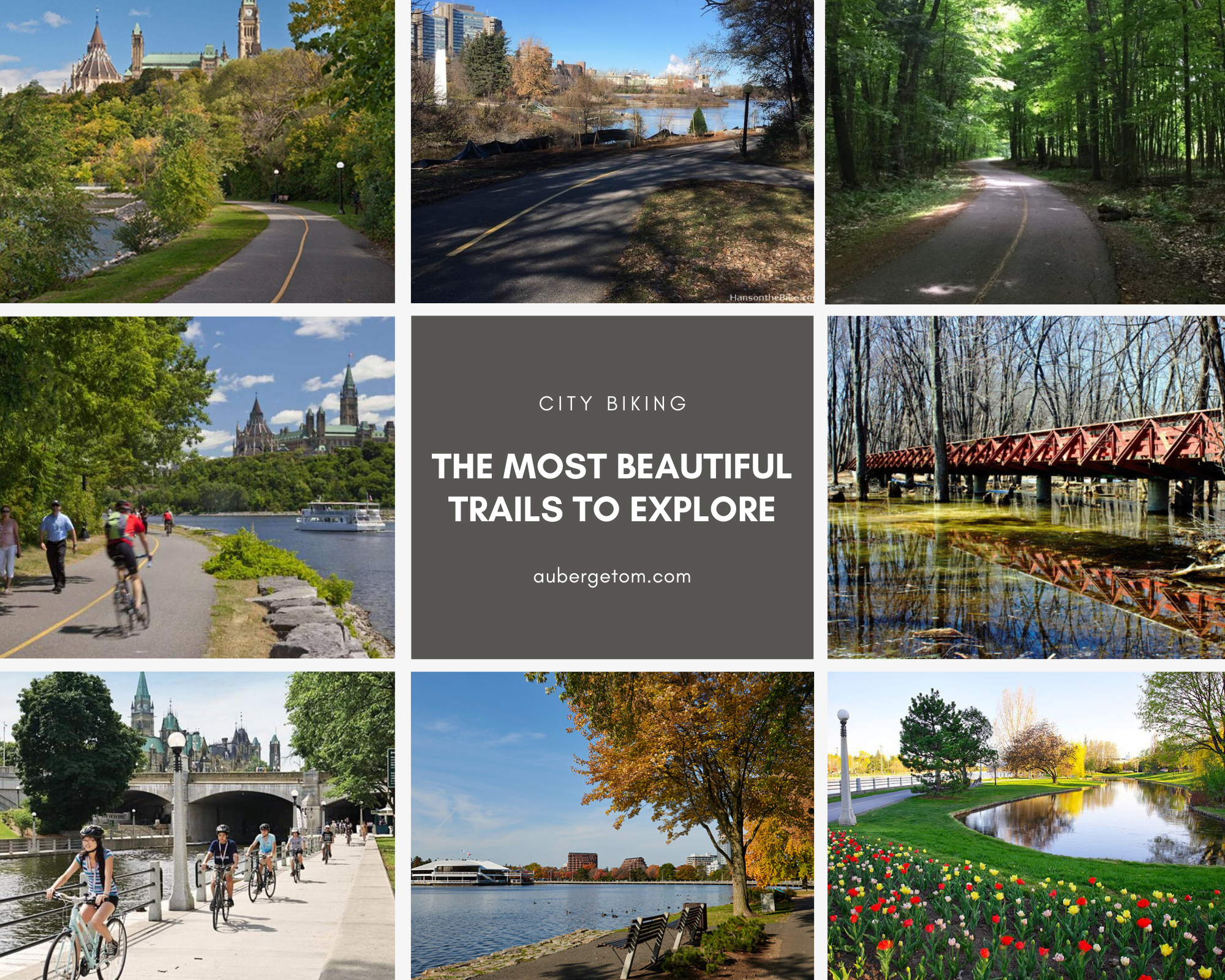
THE MOST BEAUTIFUL BIKE PATHS TO EXPLORE IN THE CITY
What could be better than visiting a city by bike to appreciate all its details and subtleties! Here in the Outaouais, the tourism bicycle is in the spotlight thanks to the many cycling paths that cross or circle both sides of the Ottawa River, allowing you to visit the region at your own pace and according to your desire of the moment.
I have chosen for you the most beautiful cycling paths in Gatineau and Ottawa. They all have the characteristic of crossing bucolic landscapes and the great majority of them border a watercourse. Some even offer the most beautiful views on the two cities and their famous buildings.
One of the advantages of writing this blog is that having lived in the region most of my life, I know these tracks by heart for having taken them so many times that it is difficult for me to give you an exact number. So I'm speaking to you from experience and I'm very excited that you will be able to explore them as well.
Oh yes, we have two very good bikes equipped with saddlebags that we gladly lend to our guests. If you ever want to go on these trails, but don't own a bike, the problem is solved. Come on, let's go! Have a good read and a good ride!
Gatineau - Route Verte - Voyageurs Pathway
Route Verte 1 - Voyageurs Pathway
Route Verte 1 spans the province of Quebec and the section that runs through Gatineau, the Voyageurs Pathway, skirts the Ottawa River while offering magnificent views of the city of Ottawa. This trail, the most beautiful in my opinion, will take you through very different natural settings and, at times, will make you think you are miles away from the city. But what makes this trail so attractive are the different viewpoints that line the pathway from beginning to end. You'll want to make regular stops to admire the scenery, so give yourself time to stroll along it.
Features: Fully paved, easy to intermediate route, high* to very high traffic; 18.7 km from Lake Leamy Park (Hull sector) to Des Cèdres Park (Aylmer sector)
Sites crossed: Lake Leamy Park (it's worth taking the park trails and going to the beach); Jacques-Cartier Park and Canadian Museum of History; Bréboeuf Park; Moussette Park (beach); Deschênes Rapids; Aylmer Marina; Des Cèdres Park (beach)
Viewpoints: Casino; Prime Minister's Residence; French Embassy; Rideau Falls; Alexandria Bridge; National Gallery of Canada; Château Laurier; Rideau Canal Locks; Library of Parliament; downtown Ottawa; Ottawa River; rapids
Transits: Alexandria Bridge (to Ottawa and the ByWard Market); Portage Bridge (to Ottawa and downtown); Chaudière Bridge (to Ottawa, the War Museum and the Trans Canada Trail); Montcalm Street (Ruisseau de la Brasserie Pathway to Lake Leamy Park); Bréboeuf Park (to Gatineau Parkway and Gatineau Park Pathway); Champlain Bridge (to Ottawa and the Trans Canada Trail); Lattion Road (to Des Pionniers Pathway)
Services: picnic tables, restaurants, snack bars, ice cream parlors, cafés, bicycle repair, shops, public washrooms
Parking: Des Cèdres Park; Bréboeuf Street; Lucerne Blvd. (between Vanier Road and Robert-Stewart Road); Lucerne Blvd. (right before golf); Lucerne Blvd. (Samuel-de-Champlain Bridge); Moussette Park; Université du Québec en Outaouais ($); downtown - Hull sector ($); Maison du Citoyen (free evenings after 5 p.m. and weekends); Jacques-Cartier Park West - marina ($); Jacques-Cartier Park East; Lake Leamy Park ($)
*High traffic means that the high number of people on the trail will force you to limit your speed and watch out for pedestrians and other strollers.

Gatineau - Gatineau Park Pathway
Gatineau Park Pathway
The Gatineau Park Trail begins on de la Mine Rd between Maître-Burger and du Quartz streets and crosses Gatineau Park to end at Alexandre-Taché Blvd. Although it winds mainly through the forest, it occasionally crosses the Gatineau Parkway*. This trail is ideal for those who want to ride in complete tranquility, away from the crowds and noise.
Features: Fully paved, easy to intermediate route, average traffic; 9 km from de la Mine Rd to Alexandre-Taché Blvd
Sites crossed: Gatineau Park, Gatineau Park Welcome Area (P3)
Viewpoints: trail mainly in the forest, under the canopy of trees
Transits: Leamy Creek Pathway to Relais Plein Air or to Cité-des-Jeunes Blvd. up to Lake Leamy; trail 26 to Gatineau Parkway or to Cégep de l'Outaouais; Lac des Fée Pathway to Des Fées Lake and Lac des Fées Parkway (Gamelin street and Hull Hospital); Des Pionniers Pathway to Le Plateau district and Aylmer sector;
Services: restaurants, ice cream parlors, cafés, bicycle repair
Parking: Gatineau Park Welcome Area (P3); Gatineau Park Visitor Center on Scott Rd in Chelsea (you can easily transit to the Gatineau Park Pathway from the Visitor Centre by using the bicycle shoulder on Scott, Kingsmere, Notch and Mine Roads); Moussette Park
*Nokia Sunday Bikedays: The Gatineau Parkway is closed to automobiles in both directions every Sunday morning from 9 am to 1 pm from June to September. It is currently closed to automobiles until June 28.

Gatineau - Leamy Creek Pathway and Gatineau River Pathway
Leamy Creek Pathway and Gatineau River Pathway
These two trails are a very interesting transit route between the Gatineau Park Pathway and the Voyageurs Pathway (Route Verte) via Leamy Lake. For nearly 10 km, you will encounter diverse landscapes, most of which are in the great outdoors and far from the noise of the city, even though the latter is never far away.
The Leamy Creek Pathway starts at the Gatineau Park Pathway and continues to the Gatineau River Pathway 5.6 km further on. This trail quickly exits Gatineau Park, crosses Cité-des-Jeunes Blvd, meanders under a canopy of trees to Highway 5, continues to Highway 105 (St. Joseph Blvd.) and ends on the other side of the boulevard at the junction of the Gatineau River Pathway (tunnels take you safely across both roads). This beautiful trail is the beginning of a route that will take you to Lake Leamy Park.
The Gatineau River Pathway begins at the junction of the Leamy Creek Pathway and ends at Fournier Blvd, at the eastern boundary of Leamy Lake Park, 4.3 km away. Starting under a canopy of trees, this trail will give you a quick glimpse of the river and will follow it all the way until it ends. Once you arrive at Lake Leamy, you could take the Lake Leamy Pathway and loop around the lake before continuing on to the Route Verte. Lake Leamy beach is a nice place to stop for a break where you will find public washrooms, a snack bar and picnic tables. The Gatineau River Pathway and the Leamy Lake Pathway both lead to the Voyageurs Pathway (Route Verte).
Features: Fully paved; easy to intermediate route; low to medium traffic depending on the sector and the time of day; 9,9 km from the Gatineau Park Pathway to Fournier Blvd (plus 2.4 km if you do the loop around the lake)
Sites crossed: Gatineau Park, Casino; Lake Leamy; Lake Leamy Park
Viewpoints: Gatineau River; Casino, Lake Leamy, Lady Aberdeen Bridge
Junctions to other Pathways: Gatineau Park Pathway (to Gatineau Park and Chelsea); Lake Leamy Pathway; Ruisseau de la Brasserie Pathway; Voyageurs Pathway (Route Verte)
Transits: Gatineau Park and Chelsea or Ottawa via the Gatineau Park Pathway or the Gatineau Parkway; Ottawa via the Voyageurs Pathway (Route Verte); Montreal via the Voyageurs Pathway (Route Verte)
Services: restaurants; snack shacks; kayaks and canoe rentals; picnic tables; public washrooms
Parking: Lake Leamy West; Lake Leamy Park East

Ottawa - Trans Canada Trail - West
Trans Canada Trail - Ottawa River Pathway West
From downtown Ottawa to Britannia Beach, the Ottawa River Pathway (Trans Canada Trail) follows Sir John A. MacDonald Drive* along the banks of the river. To the east, the views of downtown Ottawa and Gatineau are magnificent, while to the west, the view of the river is ever-present and equally captivating. At times, it feels like you're in the country and yet you're in the city. From this trail, you will see rapids, cross parks and beaches, and you can travel to Chinatown, Little Italy and Westboro, as well as to Gatineau via the Samuel de Champlain Bridge.
Features: Fully paved; easy course (very little gradient); high to very high traffic, especially during rush hour and weekends | 26 km round trip
Sites crossed: Rideau Canal Locks; Canadian War Museum; Remic Rapids Park; Kitchissippi Lookout; Westboro Beach; Deschênes Rapids Lookout; Britannia Park and Beach
Views: Parliament Hill; Supreme Court of Canada; Victoria Island; Chaudière Falls; John Ceprano Rock Sculptures; Bate Island
Transits: Portage Bridge (towards Gatineau and the Voie Verte); Bronson Street (towards Chinatown); Chaudière Bridge (towards Gatineau and the Voie Verte); Preston Street (towards Little Italy); Samuel-de-Champlain Bridge (towards Gatineau and the Voie Verte); Island Park Drive (towards Westboro)
Services: picnic tables; restaurants; ice cream parlors; cafés; snack bars; bicycle repair; public washrooms
Parking: Downtowns of Ottawa and Gatineau ($); Maison du citoyen in Gatineau (free evenings after 5 p.m. and weekends) - you will have to cross the Portage Bridge; Tunney's Pasture (free evenings and weekends); Remic Rapids; Samuel de Champlain Bridge; Kitchissippi Lookout (Westboro Beach); Deschênes Rapids Lookout; Britannia Beach
*Nokia Sunday Bikedays: Sir John A. MacDonald Drive is closed to automobiles in both directions every Sunday morning from 9:00 a.m. to 1:00 p.m. from June to September.

Ottawa - Trans Canada Trail East
Trans Canada Trail - Ottawa River Pathway East
From Rideau Hall (residence of the Governor General of Canada), you can drive to Petrie Island Beach on the pleasant Ottawa River Trail, which will take you on a scenic ride with its interesting sites and beautiful views.
To get to Rideau Hall, simply go to the National Gallery of Canada (across the Alexandria Bridge) and head east on Sussex Street. Drive past Rideau Hall and continue for a few meters to the roundabout where you will see the access to the pathway that begins at this very spot, just after the exit to Princess Avenue.
The Rockcliffe Park area is known for its large and prestigious properties, most of which are home to embassies and high dignitaries. And because it is built on top of a cliff, the view of the Ottawa River, Gatineau and the region is breathtaking.
IMPORTANT: At the Ottawa New Edingburgh Club, you have two options: either continue straight on the same pathway that becomes the Aviation Pathway and follows the Sir Georges-Étienne Cartier Parkway* or take the Ottawa River Pathway on the left, which descends towards the river and follows the riverbank for several kilometers. The Aviation Pathway joins the Ottawa River Pathway a few kilometers further along.
Features: Paved with some gravel sections, especially along the Ottawa River shoreline; easy to intermediate route; medium to high traffic (depending on location); 23.3 km from the National Gallery of Canada to Petrie Island
Sites crossed (from the National Gallery of Canada): Royal Canadian Mint; Earnscliffe National Historic Site; Rideau Falls Park and Rideau Falls; Official Residence of the Prime Minister of Canada; Rideau Hall; Rockcliffe Park; Rockcliffe Lookout; Canada Aviation Museum (Aviation Trail); Green's Creek; Ottawa River Lookout: Rideau Canal Locks; Canadian War Museum; Remic Rapids Park; Kitchissippi Lookout; Westboro Beach; Deschênes Rapids Lookout; Britannia Park and Beach
Views: Ottawa River; Canadian Museum of History; City of Gatineau; Outaouais Hills; Gatineau River; Parc de la Baie (of particular interest during the Gatineau Hot Air Balloon Festival); Ottawa-Rockcliffe Airport
Transits: Alexandria Bridge (to Gatineau and Route Verte); St. Patrick Street (to ByWard Market); Sussex Street West (to Parliament, Rideau Canal Pathway East and West and Trans Canada Trail West)
Services: picnic tables; restaurant and public washrooms on Petrie Island
Parking: Rideau Falls; Rockcliffe Park (detour via the Rockcliffe Parkway); 5 parking lots along the Sir George-Étienne-Cartier Parkway; Massey Lane (boat landing); Petrie Island Beach
*Nokia Sunday Bikedays: A significant portion of Sir George-Étienne Cartier Parkway is closed to motorists in both directions every Sunday morning from 9 a.m. to 1 p.m. from June to September.

Ottawa - Rideau Canal Eastern Pathway
Rideau Canal Eastern Pathway - Colonel By Drive
Bicycle paths along the waterways seem to be popular because they run through greenbelts with the city - and its services - never far away. The Rideau Canal pathways are no exception, and are particularly valued for the beauty of the often bucolic scenery they offer to those who use them, and for their proximity to commercial arteries. Fancy a coffee or ice cream? You can do so by branching off onto a small adjacent street that will take you to a welcoming terrace in no time at all.
The Rideau Canal is unique in that it is bordered by two distinct pathways. On the east bank, it is the Colonel By Drive pathway and on the west bank, it is the Queen Elizabeth Driveway pathway. A few cross bridges span the canal, allowing you to easily switch from one path to the other.
The Rideau Canal Eastern Pathway runs along Colonel By Drive* and offers views of the city as it emerges on the other side of the canal. From Rideau Street at Wellington, it will take you to the beach at Mooney's Bay Park via south Dows Lake. This trail is ideal if you want to enjoy nature, wide open spaces and urban beaches.
Features: Fully paved; easy route; high to very high traffic; 8.3 km from Rideau Street to Mooney's Bay Park
Neighbourhoods: Sandy Hill; Old Ottawa East (Main Street, St. Paul University); Rideau Gardens; Old Ottawa South; Hog's Back
Parks crossed: Vincent-Massey; Hog's Back; Mooney's Bay (beach)
Viewpoints: National Arts Centre; University of Ottawa Campus; Lansdowne Park; TD Place; Hartwells Lockstation; Carleton University Campus; Rideau River; Prince of Wales Falls; Hog's Back Falls
Transits: The Corktown Footbridge (to Queen Elizabeth Driveway); crossing to University of Ottawa Campus; Main Street (to Old Ottawa East and to Rideau River Nature Trail); Pretoria Bridge (to Queen Elizabeth Driveway); Flora Footbridge (to Queen Elizabeth Driveway); Bank Street via Echo Driveway after the overpass: Bank Street North (to TD Place and Glebe), Bank Street South (to Old Ottawa South, Rideau River and Billings Bridge); University Drive (to Carleton University Campus and Rideau River)
Services: picnic tables; restaurants; ice cream parlors; cafés; shops; bicycle repair; bicycle and canoe rentals
Parking: Downtown ($); University of Ottawa ($); Old Ottawa East and Old Ottawa South (in the streets); Colonel By Drive past Bronson Street; Carleton University Campus ($); Mooney's Bay Park
*Nokia Sunday Bikedays: Colonel By Drive is closed to automobiles in both directions every Sunday morning from 9:00 a.m. to 1:00 p.m. from June to September.

Ottawa - Rideau Canal Western Pathway
Rideau Canal Western Pathway - Queen Elizabeth Drive
The Rideau Canal Western Pathway runs along Queen Elizabeth Driveway and offers views of the lush flowerbeds, small ponds and beautiful ancestral homes of the Glebe neighbourhood. From Confederation Park on Laurier and Elgin Streets, it will take you to Hartwells Lockstation via north of Dow's Lake. This trail is ideal if you want to stay close to downtown to take advantage of its many tourist attractions.
Features: Fully paved; easy route; high to very high traffic; 7.5 km from Confederation Park (Laurier Street) to Hartwells Lockstation
Neighbourhoods: Golden triangle; downtown; Glebe; Little Italy
Parks crossed: Confederation; Patterson Creek (pond); Commissioners; Dow's Lake Peninsula; Fletcher Garden
Viewpoints: National Arts Centre; Ottawa Congress Centre; University of Ottawa campus; Ottawa Farmers' Market; Lansdowne Park; TD Place; Dow's Lake; Experimental Farm; Carleton University campus
Transits: The Corktown Footbridge (to Colonel By Drive); Pretoria Bridge (to Colonel By Drive or Elgin Street and downtown); Flora Footbridge (to Colonel By Drive); Bank Street (to TD Place, Glebe and downtown); Bronson Street (to Chinatown); Preston Street (to Little Italy); Prince of Wales Drive (to Experimental Farm)
Services: picnic tables; restaurants; ice cream parlors; cafes; shops; bicycle repair; bicycle and canoe rentals
Parking: Downtown ($); Golden Triangle and Glebe Districts (time restrictions and $); Pretoria Bridge Loblaws; Landsdowne Park and TD Place ($); Dow's Lake ($); Hartwells Lockstation

Ottawa - Rideau River Eastern Pathway
Rideau River Eastern Pathway
The Rideau River Eastern Pathway begins at Rideau Falls and follows the course of the Rideau river to Mooney's Bay Park. It is further from downtown than the canal trails and offers few views of the city, but its scenery is still enjoyable because of the greenery that surrounds it at all times and the continuous presence of the river.
Features: Fully paved; easy route; medium to high traffic; 12.5 km from Rideau Falls to Mooney's Bay Park beach
Neighbourhoods: New Edinburgh; Vanier; Overbrook; Hurdman; Faircrest; Billings Bridge / Alta Vista; Confederation Heights; Hog's Back
Parks crossed: Stanley; New Edinburgh; Riverain; Vincent-Massey; Hog's Back; Mooney's Bay
Viewpoints: Rideau Falls; Minto Bridges; Carleton University Campus; Hog's Back Falls
Transits: Adawe Gateway to Strathcona Park and Sandy Hill neighbourhood; Mooney's Bay Park to Rideau Canal West Pathway and Colonel By Drive
Services: picnic tables; bicycle and canoe rentals
Parking: Rideau Falls; New Edinburgh Park; Riverain Park; Saints Peter and Paul Church (River Rd); Hurdman Transitway and O Train; Billings Bridge shopping centre; Vincent-Massey Park; Hog's Back Park; Mooney's Bay Park


All content © Auberge Tom B&B 2022.
All rights reserved.

FREE GUIDE
Download your FREE Guide on exploring 12 fantastic sites in Chelsea and surroundings, to help you plan your holiday.
